During the Revolutionary War, George Washington ordered a campaign against the Haudenosaunee and specifically the Seneca in this region for their alliance with the British. This would be known as the Sullivan-Clinton Campaign or Genocide. Washington’s soldiers destroyed Haudenosaunee orchards, crops, and villages, while capturing and imprisoning Haudenosaunee people.
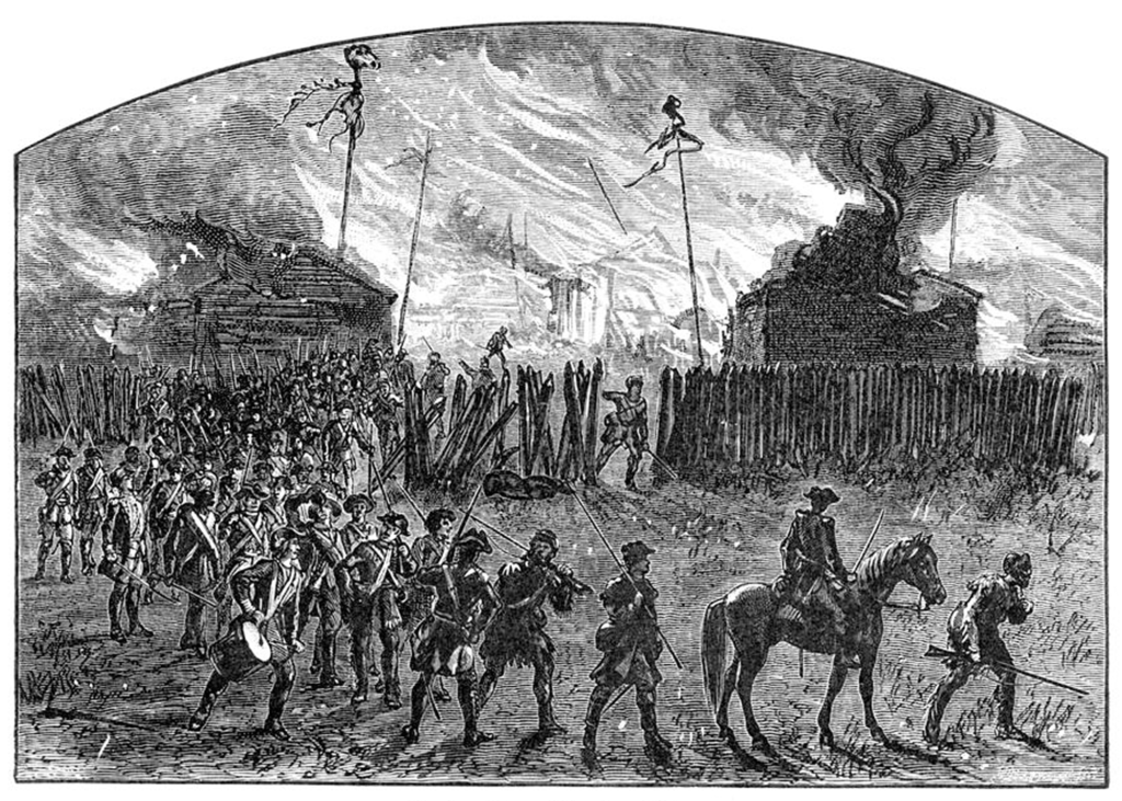
An 18th century portrait of Major General John Sullivan, who was in charge of the Sullivan-Clinton Campaign, along with Major General James Clinton. Gen. Clinton’s son, Dewitt Clinton, would later be governor of New York. The Sullivan-Clinton Campaign was responsible for the decimation of countless Seneca villages and resources, resulting in starvation and displacement. Image: New York Public Library, 1776.This map shows the path of the Sullivan-Clinton Campaign march in 1779, highlighting natural features, the army’s encampments and Haudenosaunee settlements that were attacked. Cayuga and Seneca lake are clearly identified, with Canandaigua (labelled Long Lake here), Honeoye, and Conesus Lakes partially identified, along with the Genessee River. Image: Library of Congress, 1779.This wood engraving by Alfred Waud from a later history text shows the destruction of an unknown Seneca village during the Sullivan-Clinton Campaign. Image: Library of Congress, 1876.
1792 – The First Sawmill
After the war, many former soldiers returned to settle the areas they had destroyed during the Sullivan Campaign. Gamaliel Wilder was one such soldier. In 1791, Wilder bought land in the Bristol Hills where he knew Seneca orchards had survived. By 1792, he had cut a path to the old growth forests around Briggs Creek and set up the area’s first water-powered sawmill.
Gamaliel Wilder’s grave is located in the Wilder Cemetery in South Bristol, near Stid Hill. This image shows a marker that was placed later on the approximate location of Wilder’s grave, which has been lost to time. Wilder died in South Bristol in 1823. Image: New York HIstoric – Matthew Conhead.This image is an early map of the Phelps and Gorham Purchase, which was made in 1788 and was the mechanism used to distribute land to Euro-American settlers after the Revolutionary War and the Treaty of Hartford. This map shows the measurements of the original surveys, which proved inaccurate and problematic for decades after. Wilder purchased lot no. 8 and established what would later become South Bristol and Frost Town. Image: New York GenWeb Project, 1794.An image of an abandoned sawmill from Ulster County, New York showcasing the water wheel technology that was most-likely in use when Wilder and the Frost Brothers first started using Briggs Creek at Frost Town. This mill was built in 1850. Image: New York State Archive, 1913.This Real Photograph Post Card shows a team of horses dragging a sled filled with timber. The image is undated with no known location, but probably shows a late 19th century logging scene in the surrounding region. The loggers of Frost Town used a similar sled technology to transport timber in winter. Image: Private Collection of A. Smith, Late 19th Century.